
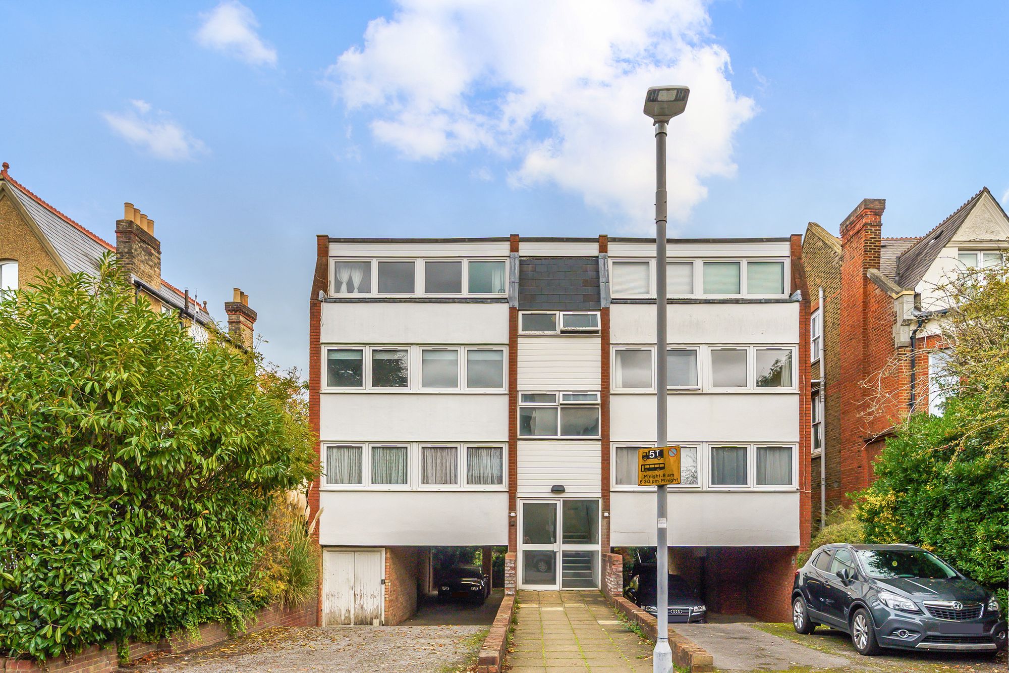
Parklands, Surbiton, KT5
About this property
Offered to the market with no onward chain and situated on a quiet residential road, this two bedroom apartment offers comfortable living in a highly convenient location, within walking distance of Surbiton Station and town centre.
The property benefits from a spacious and bright living room, providing the ideal space for relaxing and entertaining, alongside a well sized principal room and well proportioned second room.
Further benefits include a private balcony, off street parking and access to a well maintained communal garden.
Ideally positioned close to local amenities and transport links, this property offers an excellent combination of convenience, space and peaceful residential living.
Key features
Location
Schools
- The Hollyfield School and Sixth Form CentreSurbiton Hill Road, Surbiton, KT6 4TUOfsted report (inspected May 2025) Website390m5 min walk
- Surbiton Hill Nursery SchoolMiddle Green Close, Surbiton, KT5 8TDOfsted report (inspected Jun 2025) Website520m7 min walk
- Lime Tree Primary SchoolSouth Bank Terrace, Kingston upon Thames, KT6 6DGOfsted report (inspected Feb 2023) Website550m7 min walk
- Christ Church CofE Primary SchoolPine Gardens, Surbiton, KT5 8LJOfsted report (inspected Apr 2024) Website580m7 min walk
- St Matthew's CofE Primary SchoolLangley Road, Surbiton, KT6 6LWOfsted report (inspected Oct 2024) Website850m11 min walk
Stations
- Surbiton Rail Station710m9 min walk
Bus Stops
- ParklandsPARK ROAD, Berrylands90m1 min walk
- Berrylands RoadBERRYLANDS ROAD, Surbiton170m2 min walk
- Regent Road (KT5)SURBITON HILL PARK, Berrylands190m2 min walk
- Burney AvenueVILLIERS AVENUE, Berrylands250m3 min walk
- Berrylands RoadBERRYLANDS ROAD, Surbiton250m3 min walk
Restaurants & Cafés
- New Kwun Sing15 Berrylands Road, Surbiton, KT5 8QX210m3 min walk
- Ploy's Thai Bistro110 Ewell Road, Surbiton, KT6 6HA590m7 min walk
- Caffetteria Maruzzella610m8 min walk
- Icon Community Coffee House120 Ewell Road, Surbiton, KT6 6HA620m8 min walk
- Oniseh Persian Cuisine135 Ewell Road, Surbiton, KT6 6AL650m8 min walk
Parks
- Middle Green520m6 min walk
- Claremont Gardens700m9 min walk
- The WoodSurbiton, KT6 6DS740m9 min walk
- Fishponds Park850m11 min walk
- Hogsmill STW Nature Reserve940m12 min walk
Healthcare
- Stedham House Dental Surgery34 Ewell Road, Surbiton, KT6 6HX380m5 min walk
- Shan Pharmacy106 Ewell Road, Surbiton, KT6 6HA580m7 min walk
- Newman PharmacyEwell Road, Surbiton, KT6 6EZ590m7 min walk
- The Dentgist Group116 Ewell Road610m8 min walk
- Smartdontics8 Central Parade, Surbiton, KT6 4PJ620m8 min walk
Leisure
- Motion Training CrossFitEwell Road, Surbiton, KT6 6AB240m3 min walk
- Surbiton Racket and Fitness Club400m5 min walk
- Surbiton Hill Methodist Tennis Club450m6 min walk
- Fitbox118 Ewell Road610m8 min walk
- The Gym15-17 Victoria Road830m10 min walk
Contains public sector information licensed under the Open Government Licence v3.0. Places data © OpenStreetMap contributors. Distances are straight-line; walking times are estimates.