
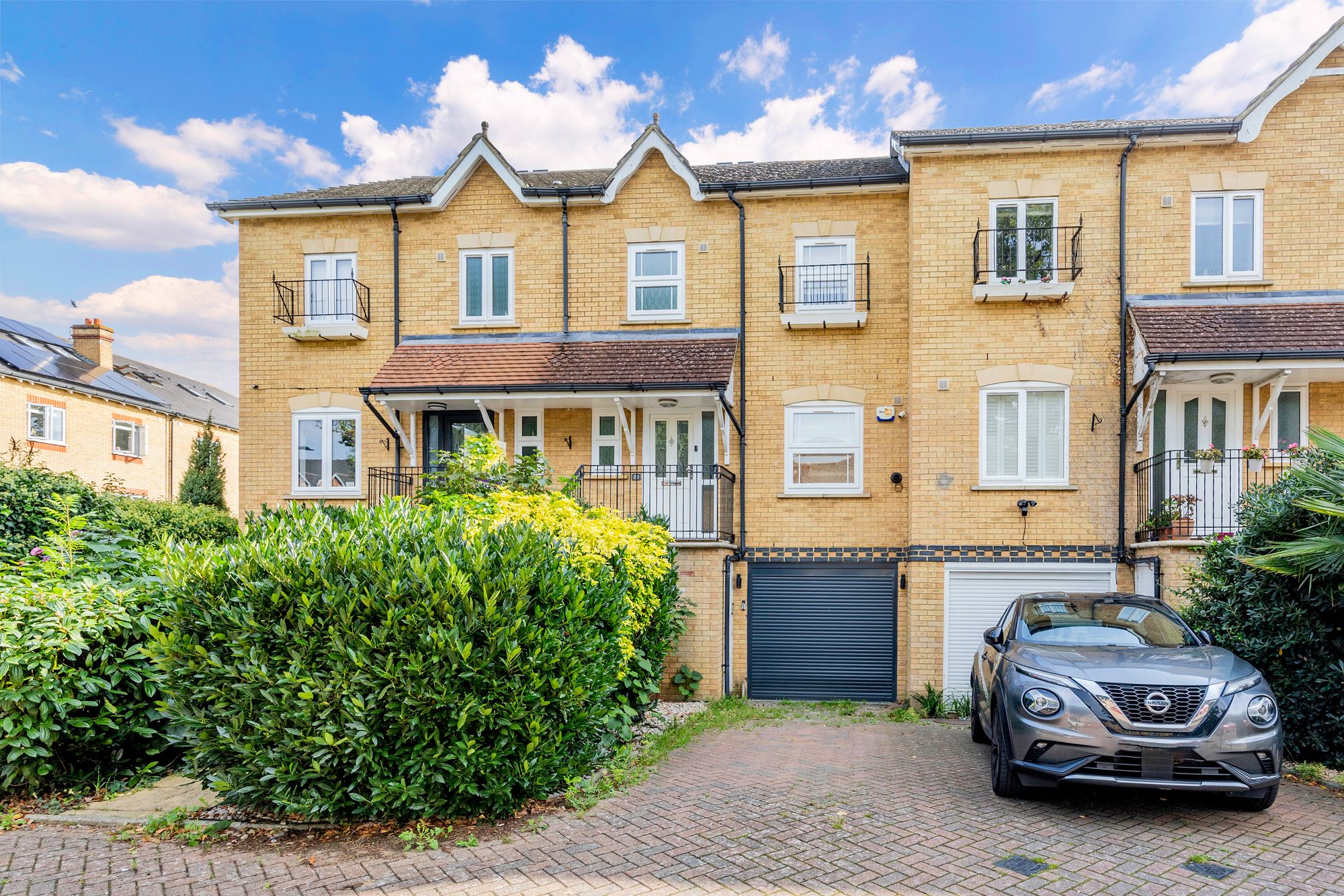
1 / 18
Let Agreed
Lynwood Road, Thames Ditton, KT7
3 Bedrooms
3 Bathrooms
1 Reception room
£2,750
About this property
-
Within walking distance of Surbiton and Hinchley wood train station
-
Private development
-
Immaculately presented
-
Close to excellent primary and secondary schools
-
Private garden
Key features
Tenure
Ask Agent
Council tax band
G
Electric
Ask Agent
Water
Ask Agent
Heating
Ask Agent
Broadband
Ask Agent
Sewerage
Ask Agent
Flooded in last 5 years
No
Flood defences
No
Sources of flood
Ask Agent
Private rights of way
No
Public rights of way
No
Restrictions
No
Listed property
Ask Agent
Location
Schools
- Hinchley Wood SchoolClaygate Lane, Esher, KT10 0AQOfsted report (inspected Oct 2023) Website530m7 min walk
- Hinchley Wood Primary SchoolClaygate Lane, Esher, KT10 0AQOfsted report (inspected Mar 2024) Website640m8 min walk
- Weston Green Preparatory SchoolWeston Green Road, Thames Ditton, KT7 0JNWebsite750m9 min walk
- Thames Ditton Junior SchoolMercer Close, Thames Ditton, KT7 0BSOfsted report (inspected Feb 2026) Website980m12 min walk
Stations
- Hinchley Wood Rail Station430m5 min walk
- Esher Rail Station970m12 min walk
Bus Stops
- Couchmore AvenuePortsmouth Road, Hinchley Wood300m4 min walk
- Cumberland DriveManor Road North, Hinchley Wood350m4 min walk
- Hinchley Wood Railway StationManor Road North, Hinchley Wood410m5 min walk
- Brooklands RoadPortsmouth Road, Hinchley Wood450m6 min walk
- Scilly IslesPortsmouth Road, Hinchley Wood460m6 min walk
Restaurants & Cafés
- Panshi7 Station Approach, Esher, KT10 0SP430m5 min walk
- Costa30 Station Approach, Esher, KT10 0SR490m6 min walk
- Coffee and Juice Bar930m12 min walk
Parks
- Lynwood Road Recreation Ground220m3 min walk
- Weston Green Sports Club570m7 min walk
- Weston Green600m8 min walk
- Weston Green650m8 min walk
- Weston Green680m9 min walk
Healthcare
- Weston Cottage Dental PracticePortsmouth Road650m8 min walk
Leisure
- Thames Ditton and Esher Golf ClubPortsmouth Road, Esher, KT10 9AL800m10 min walk
Contains public sector information licensed under the Open Government Licence v3.0. Places data © OpenStreetMap contributors. Distances are straight-line; walking times are estimates.